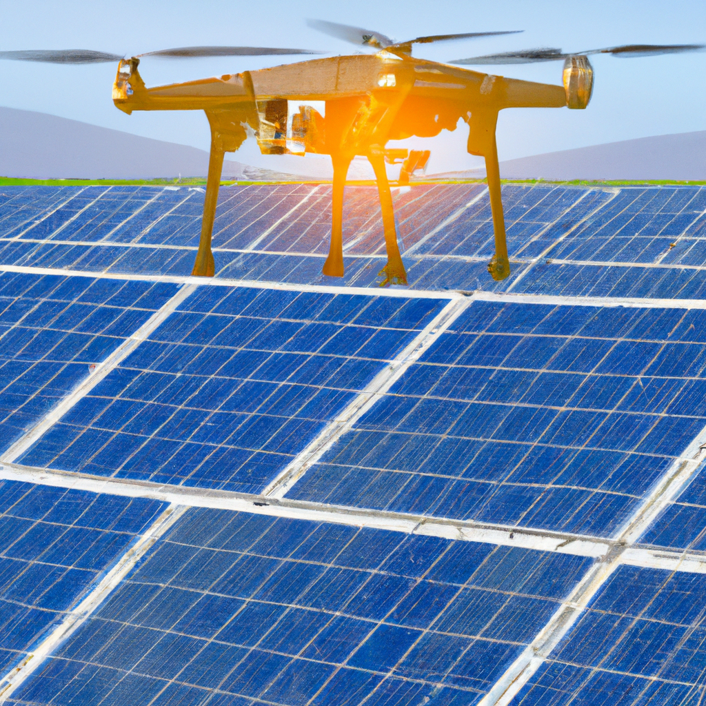
In commercial media production, drone technology is no longer limited to sweeping aerial shots and cinematic property overviews. Businesses today increasingly need visual assets that do more than look impressive. They need imagery that helps explain conditions, support decisions, document projects, and communicate technical information clearly to clients, stakeholders, and internal teams.
That is where LiDAR and thermal FLIR infrared drone services have become especially valuable.
For organizations in construction, facilities management, real estate, manufacturing, engineering, infrastructure, roofing, logistics, and property development, these specialized drone services can provide a level of insight that conventional photography and video alone often cannot deliver. They help reveal the shape of a site, the behavior of a structure, and the thermal patterns that may point to issues or opportunities needing closer attention.
At St Louis Video Editing, we understand that advanced aerial capture is only part of the equation. The other part is what happens after capture. How the visuals are processed, organized, refined, interpreted, and edited can make the difference between raw imagery and a genuinely useful business asset. That is why our approach to LiDAR and thermal infrared drone work is shaped not only by production experience, but by a deep understanding of post-production and media workflow.
Why specialized drone imaging matters
Standard aerial footage still has a clear place in marketing and communications. It is excellent for showing scale, context, curb appeal, and progress. But many commercial clients now need more than visuals that simply showcase a property or project from above.
They need better information.
They need broader visibility.
They need stronger documentation.
They need imaging that can support maintenance planning, project communication, reporting, and brand credibility.
LiDAR and thermal infrared imaging answer those needs in very different ways, but both move commercial drone work into a far more practical category of service.
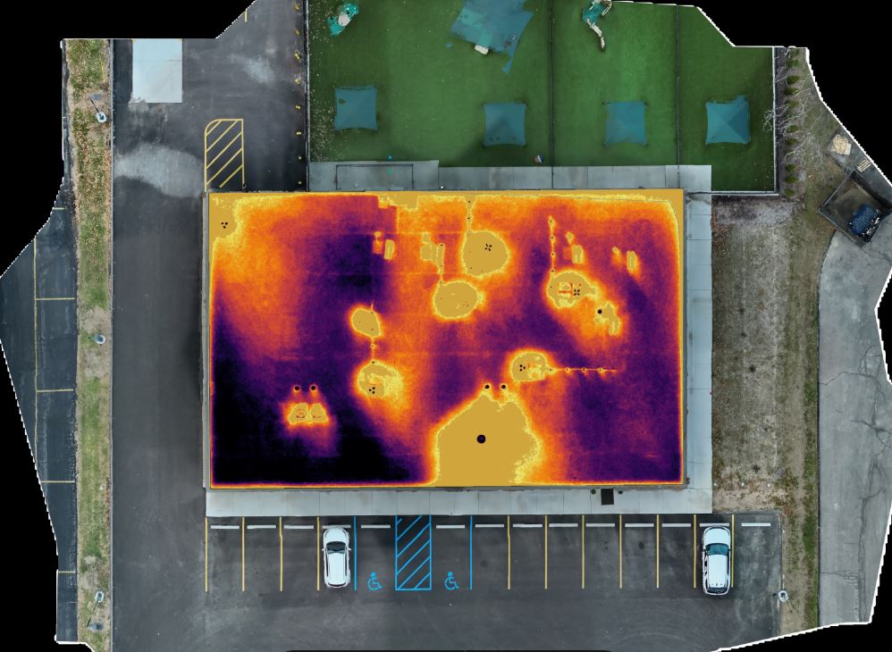
What LiDAR brings to a project
LiDAR, or Light Detection and Ranging, is used to gather highly detailed spatial information by measuring distances with laser pulses. The result is a much richer understanding of terrain, elevation, contours, structures, and site relationships.
For commercial clients, LiDAR can be a major advantage when standard photography does not provide enough depth. A normal aerial image may show the look of a site, but LiDAR helps describe its physical form more precisely. That makes it useful for projects where layout, grade, topography, volume, or terrain structure matter.
LiDAR can be especially valuable for:
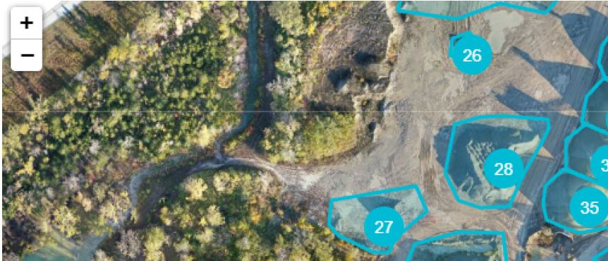
- construction and development sites
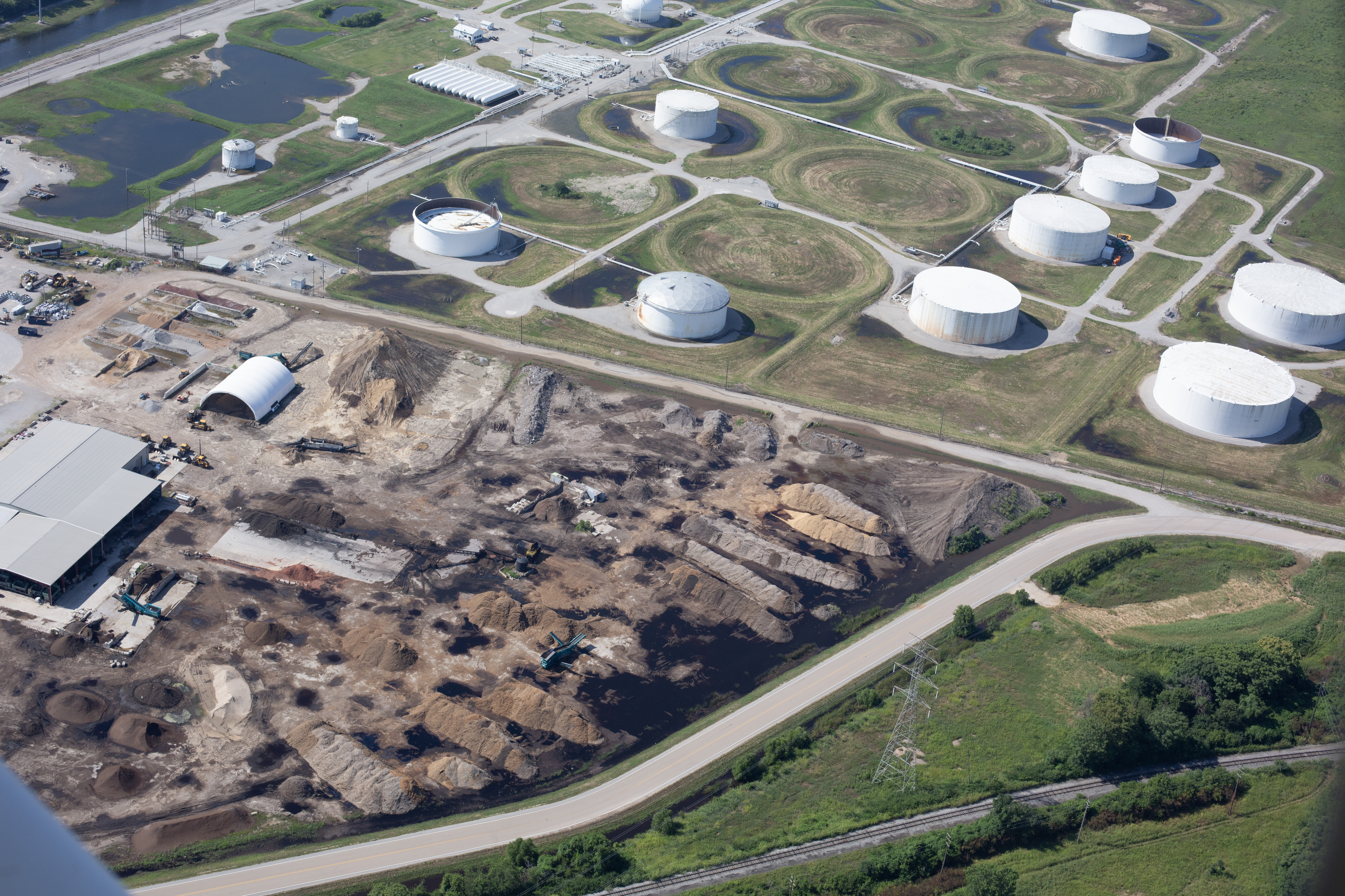
- large industrial properties
- business parks and campuses
- logistics yards
- infrastructure corridors
- land planning projects
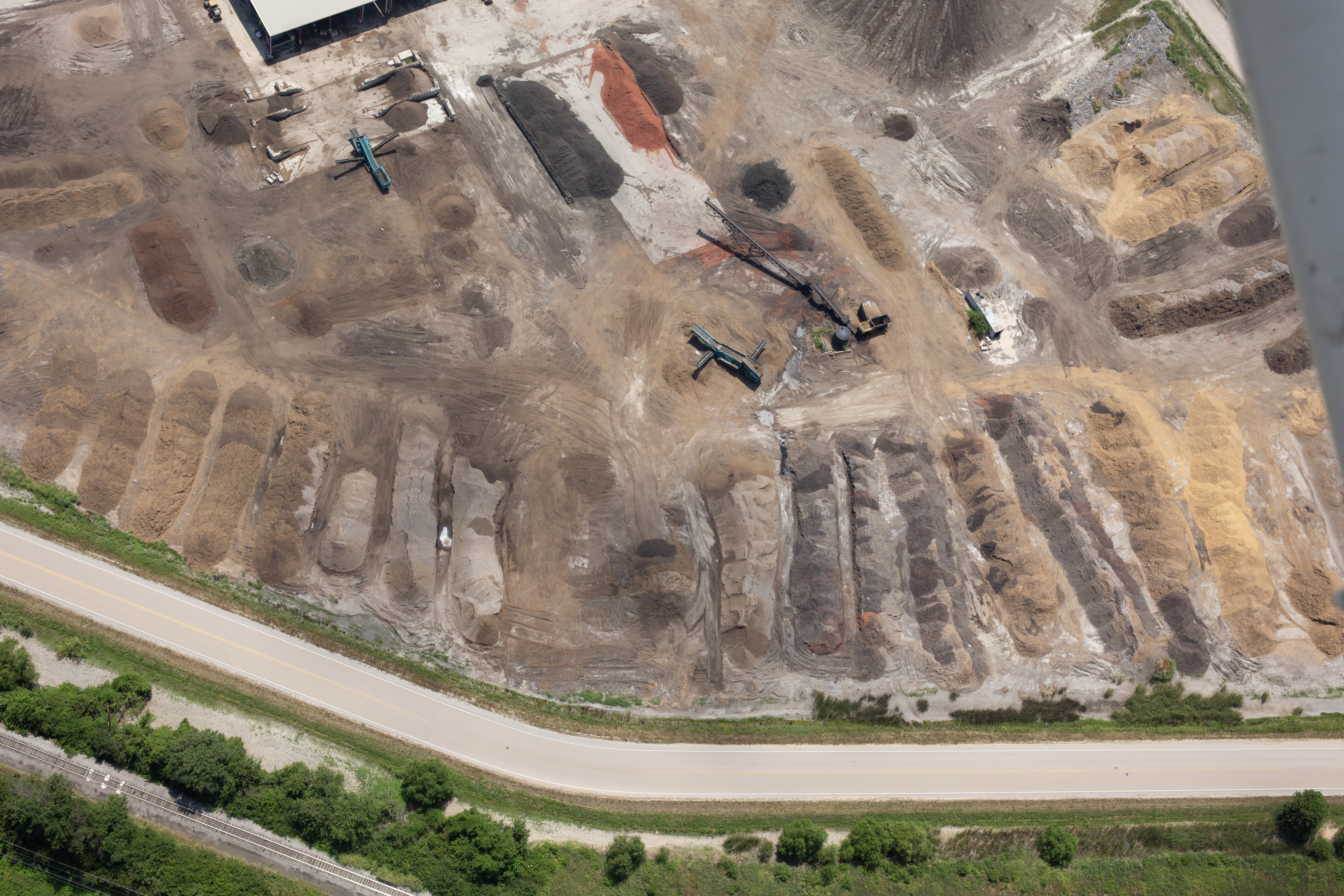
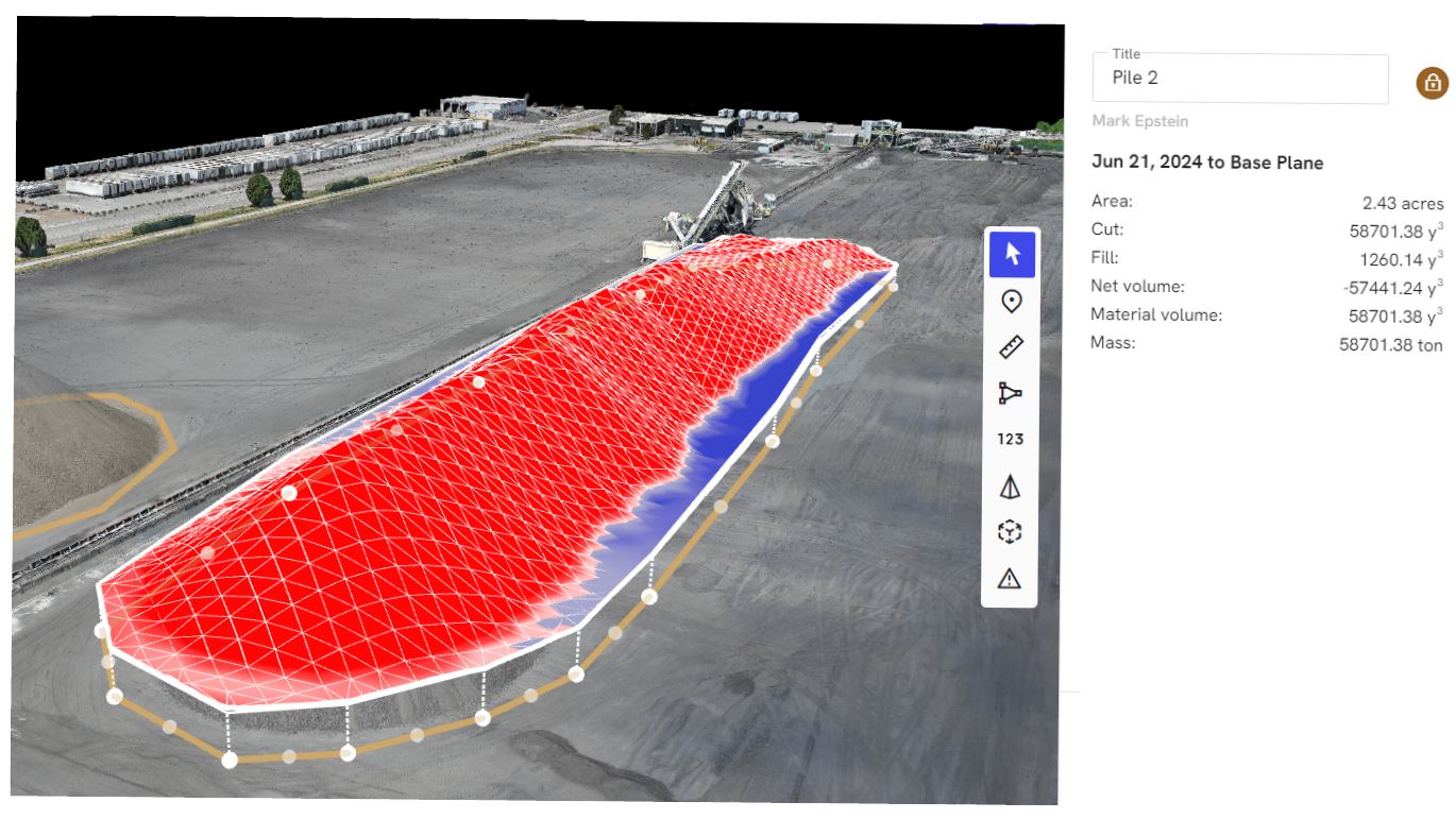
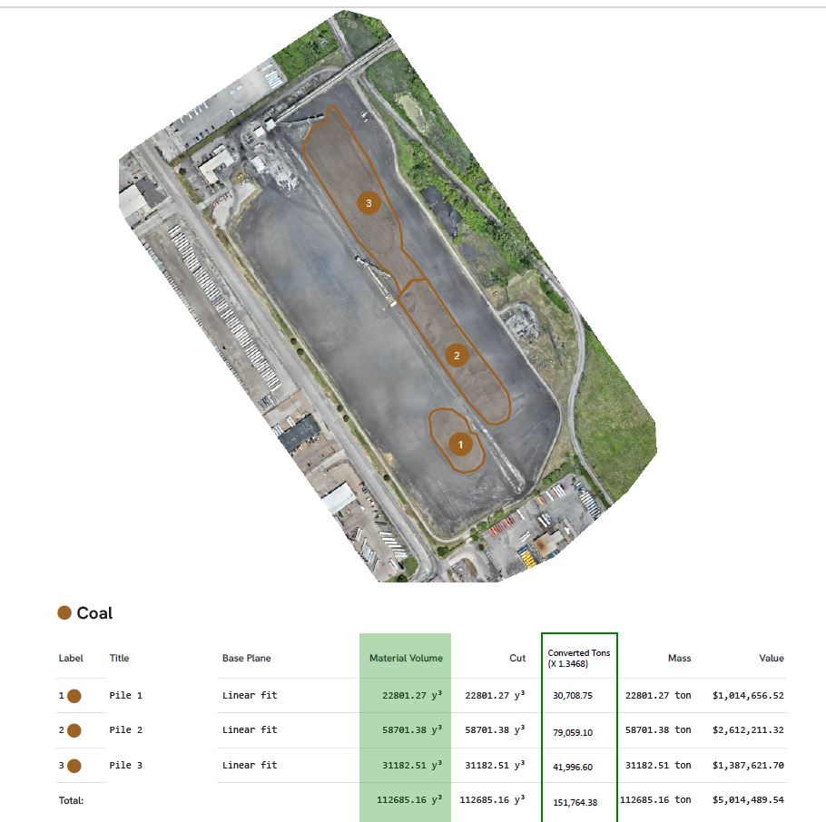
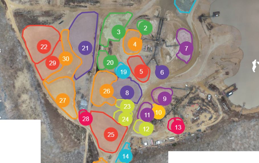
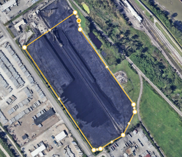
- stockpile and aggregate environments
- expansive commercial sites requiring better visual records
For decision makers, the value lies in gaining a clearer understanding of the environment itself, not just a surface impression.
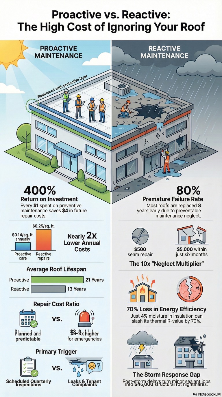
What thermal FLIR infrared imaging helps reveal
Thermal imaging works differently from LiDAR and serves a different business purpose. Instead of measuring shape and space, it detects temperature variation across surfaces and structures.
That can be extremely useful when a commercial building or system appears normal in visible light but may be behaving differently thermally.
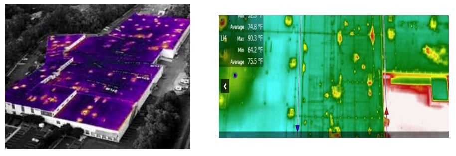
A roof can look fine from a standard aerial camera but display inconsistent thermal patterns.
A building envelope may show signs of heat loss or insulation issues only in infrared.
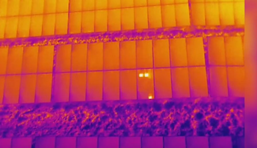
A solar array may reveal underperforming zones through unusual heat signatures.
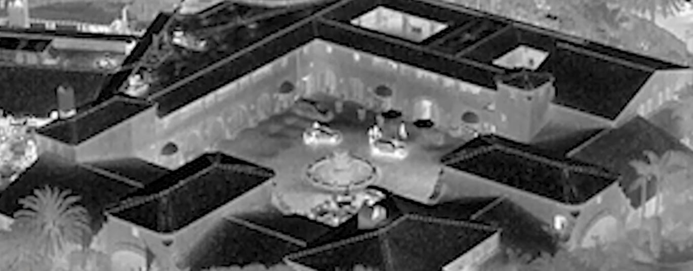
An industrial property may contain equipment or structural areas with hotspots that deserve closer evaluation.
Thermal FLIR infrared drone imaging gives organizations a broader and often more efficient way to observe temperature-related conditions over large areas. It is not a replacement for licensed inspectors, engineers, roof consultants, electricians, or HVAC specialists. It is a tool that supports clearer visual analysis and more informed follow-up.
Why these services are relevant in the St. Louis market
St. Louis businesses and institutions manage a wide range of properties and operational environments. Warehouses, medical facilities, schools, industrial sites, commercial roofs, office buildings, construction projects, municipal properties, and manufacturing campuses all present challenges that are difficult to fully capture from ground level.
In many of these cases, advanced drone imaging can provide a more complete perspective.
Facility managers may need better visibility across a roof or large exterior.
Developers may need stronger documentation of land or site conditions.
Construction teams may need more informative progress visuals.
Property managers may need better communication tools for ownership groups or service vendors.
Marketing departments may want more sophisticated visual content that demonstrates innovation and operational capability.
LiDAR and thermal drone services can support all of those objectives, especially when the final outputs are refined into polished, usable deliverables.
The importance of editing and post-production in advanced drone work
This is where many businesses underestimate the process.
Capturing specialized drone imagery is only the beginning. Raw material alone is not always useful in its original form. Commercial clients often need edited deliverables that are easier to understand, present, archive, and repurpose.
That might mean:
- edited visual summaries for stakeholders
- organized media for project documentation
- refined clips for marketing presentations
- side-by-side visual comparisons
- polished content for websites and proposals
- visuals integrated into a broader video or branded communication piece
At St Louis Video Editing, we know that how imagery is handled after the flight is often what determines its real value. Strong editing turns raw technical capture into something coherent, professional, and more useful to the client’s actual business needs.
LiDAR and thermal imaging are not interchangeable
Although these services are often grouped together, they solve different problems.
LiDAR is best for understanding the physical structure of a site. It helps define land, contours, surface relationships, and spatial organization.
Thermal infrared imaging is best for identifying heat-related irregularities and temperature patterns across roofs, structures, equipment, and systems.
One is about form and geometry.
The other is about thermal behavior.
Choosing the right service depends on the goal of the assignment. Some projects call for one. Some benefit from both. The strongest results come when the production team understands that distinction and aligns the workflow with the client’s actual objective.
Commercial use cases for LiDAR drone services
LiDAR is particularly useful where clients need more than basic aerial visibility.
Construction firms may need stronger site documentation and spatial understanding.
Developers may want clearer visual records to support planning and communication.
Industrial operators may need better site layout visibility across large and active properties.
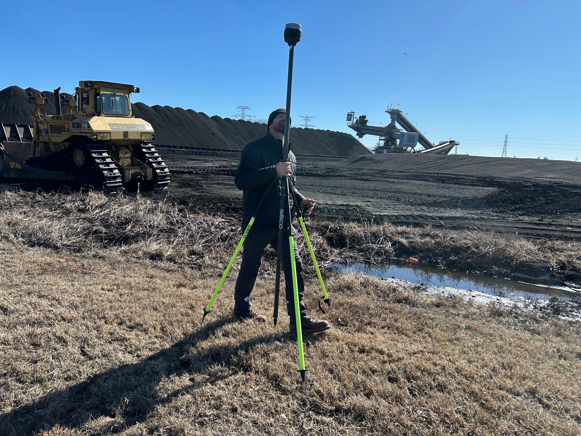
Stockpile and material-handling environments may use LiDAR when shape and volume matter.
Corporate campuses, schools, and healthcare facilities may benefit from detailed site views that support renovation, expansion, and infrastructure planning.
In each case, LiDAR provides more than an attractive image. It creates a more informative record of the environment.
Commercial use cases for thermal drone imaging
Thermal infrared drone services are often most valuable where organizations need to review large surfaces or systems for irregular temperature behavior.
Commercial roof screening is a major use case, especially for broad roof areas that are difficult to assess quickly from the ground.
Building envelope review can also benefit from infrared imaging where heat loss or exterior performance issues are part of the concern.
Solar panel fields and rooftop systems may show irregular thermal signatures that help identify performance concerns.
Industrial and mechanical areas may benefit from thermal review when unusual heat concentration could indicate maintenance priorities.
For many clients, thermal imaging helps create a faster path to visibility and better prioritization.
Why experience matters in technical drone assignments
Advanced drone imaging is not a plug-and-play service. The equipment matters, but the outcome depends just as much on planning, timing, environment, workflow, and deliverables.
Thermal flights can be affected by sun exposure, weather, time of day, recent moisture, material type, and operational status of the asset being reviewed.
LiDAR flights are influenced by mission planning, site obstacles, vegetation, output needs, and how the data or visuals will ultimately be used.
That is why businesses should work with a team that understands more than flying. They should work with professionals who understand production, location logistics, business communication, and post-production.
The communication value of advanced drone visuals
There is also a broader advantage to this kind of imaging. LiDAR and thermal visuals can be powerful communication tools.
They can strengthen internal reporting.
They can help explain technical conditions to non-technical stakeholders.
They can add credibility to proposals, presentations, and case studies.
They can be repurposed into polished branded content for web and marketing use.
For many businesses, the ability to turn specialized drone imagery into edited, client-ready media is what makes the service far more valuable. This is especially true for organizations that need both technical usefulness and professional presentation.
A smarter direction for modern visual production
Commercial photography and video are evolving. Clients increasingly want content that informs as well as impresses. They want assets that support business goals, not just attractive visuals for a website.
LiDAR and thermal FLIR infrared drone services fit that shift perfectly. They expand the role of aerial imaging, making it more useful for documentation, planning, facility review, property oversight, and brand communication.
When those visuals are paired with strong editing and post-production, they become even more valuable. They become assets that can live across reports, presentations, internal workflows, marketing materials, and long-term project archives.
St Louis Video Editing for LiDAR and Thermal FLIR Infrared Drone Services
At St Louis Video Editing, we bring a post-production mindset to every visual assignment. We understand that capturing advanced imagery is important, but shaping it into something polished, organized, and effective is just as critical. That perspective helps our clients get more practical value from LiDAR and thermal infrared drone services, whether the goal is documentation, communication, technical review, or branded content.
St Louis Video Editing is a full-service professional commercial photography and video production company with the right equipment and creative crew service experience for successful image acquisition. We offer full-service studio and location video and photography, as well as editing, post-production and licensed drone services. St Louis Video Editing can customize your productions for diverse types of media requirements. Repurposing your photography and video branding to gain more traction is another specialty.
We are well-versed in all file types and styles of media and accompanying software. We use the latest in Artificial Intelligence for all our media services. Our private studio lighting and visual setup is perfect for small productions and interview scenes. Our studio is large enough to incorporate props to round out your set. We support every aspect of your production—from setting up a private, custom interview studio to supplying professional sound and camera operators, as well as providing the right equipment—ensuring your next video production is seamless and successful. We can fly our specialized drones indoors.
Since 1982, St Louis Video Editing has worked with many businesses, marketing firms, and creative agencies in the St. Louis area for their marketing photography and video. When your project calls for advanced aerial imaging and polished final deliverables, our team is prepared to help you turn specialized drone capture into a more informative, more versatile, and more valuable visual asset.
